Ahead of Hurricane Erin’s arrival, officials on North Carolina’s Outer Banks have called for mandatory evacuations. On August 17, officials announced a state of emergency across Dare County and mandatory evacuations for the entirety of Hatteras Island. The evacuation mandate, issued for “Zone A,” applies to all seven of the Hatteras Islands’ unincorporated communities – Rodanthe, Waves, Salvo, Avon, Buxton, Frisco, and Hatteras Village. Residents on the Outer Banks-based island need to evacuate by 8 a.m. local time on Tuesday. Visitors need to leave by 10 a.m.
The county’s announcement notes that “coastal flooding and ocean overwash” could occur as soon as August 19 and “continue through” August 21. Local senior leaders say, “While Hurricane Erin is expected to stay well off our coast, the system will continue to increase in size and is forecast to bring life-threatening impacts to the Dare County coastline.” Notably, Dare County is already under a coastal flood watch.
“Now is the time to make final preparations, secure property, evacuate with all personal belongings, and follow instructions from your property management company,” the county warns in the evacuation notice.
What Else Is There To Know About The North Carolina Mandatory Evacuations?
Those in Dare County should heed officials’ warnings and take action. The local advisory noted that once the inclement weather arrives, “portions of N.C. Highway 12 on Hatteras Island will likely be impassable for several days.”
There are two evacuation routes, Highway 64 and Highway 158. The county says that though GPS devices may say that Highway 64 is the longer route, it’s usually faster because of “less congestion and traffic lights.” Another benefit of taking Highway 64 westbound is that it leads to Interstate 95, which can take you north or south from there. Highway 158 may be more beneficial for travelers heading northbound toward the North Carolina-Virginia border from the Northern Outer Banks. However, there could be traffic congestion where locals and those from nearby counties try to get on the latter highway.
Those in Dare County should also know that there’s currently a ban on swimming in the Atlantic Ocean. The prohibition is due to anticipated “life-threatening” currents and ocean conditions. August 20 through August 21 are expected to have “the most dangerous conditions.”
Residents and visitors in Dare County should regularly check its website for updates, in addition to those from the National Weather Service.
Where Is Hurricane Erin Heading?
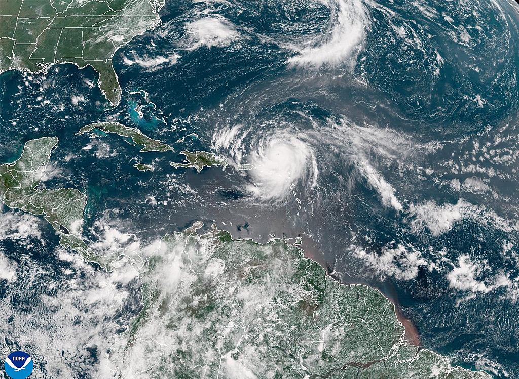
Hurricane Erin is the first hurricane of the 2025 Atlantic season. According to The Weather Channel, the hurricane is anticipated to be closest to the United States’ East Coast by Thursday morning. Jeff Berardelli highlighted on X that Hurricane Erin could include some “rogue” 100-foot high waves. In an August 18 update from the National Hurricane Center (NHC), it said the hurricane – a Category 4 – is “likely to become even larger over the coming days.” At that time, Turks and Caicos and the Southeast Bahamas were under tropical storm warnings. Meanwhile, the Central Bahamas are under a tropical storm watch.
“Interests in the northwestern Bahamas, the North Carolina Outer Banks, and Bermuda should monitor the progress of Erin,” says the NHC. “Erin is likely to remain a dangerous major hurricane through the middle of this week.”


