One of the world’s most iconic long-distance hiking trails for hiking enthusiasts is the Pacific Crest Trail (PCT). It stretches 2,650 miles from the Mexican border in California to the Canadian border in Washington.
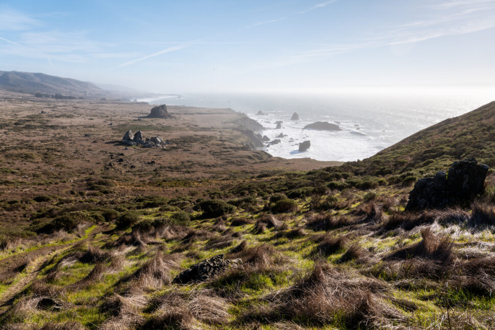
What makes the PCT iconic is the landscape along the way. It’s more than an adventure. Hiking the PCT is a transformative experience that will challenge your physicality and mentality. The challenge is worth the reward because there is nothing like it. Hikers trek America’s most beautiful and coveted landscapes, including the deserts in Southern California, the high peaks of the Sierra Nevada, and more.
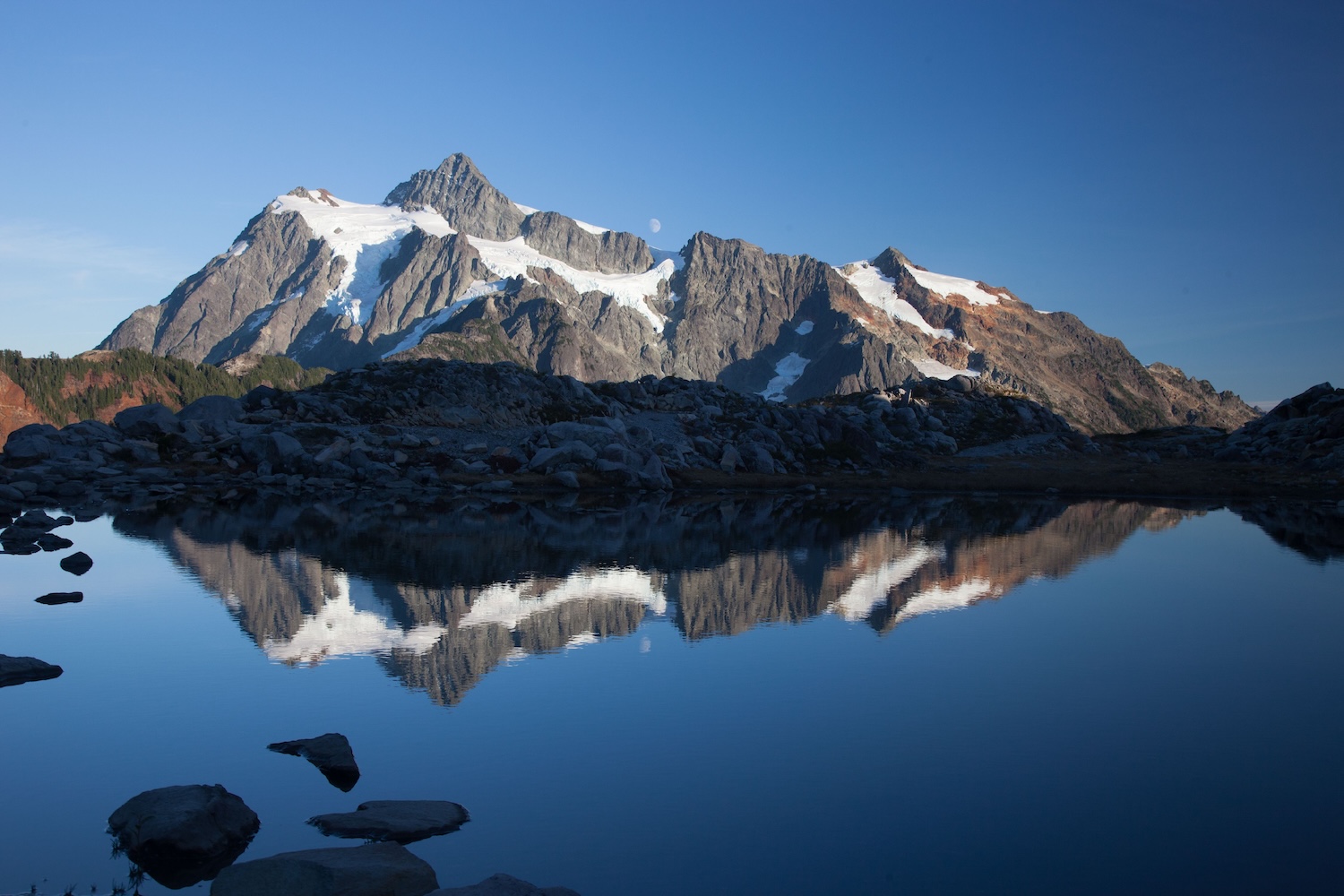
The Pacific Crest Trail is the longest designated hiking trail in the world. It’s divided into 29 sections ranging between 40 and 15 miles long. With more than 100 major mountain passes, some highlights are Mount Laguna, Bishop Pass, Castle Crags, Kearsarge Pass, and Glacier Peak Wilderness. The best time to see these incredible highlights along the PCT is late summer and early fall, when the snow has melted, and the weather is more stable.
Hiking the PCT, while exhilarating, can be downright dangerous. Preparation and the proper gear are necessary to make the four-to-six-month hike.
Quick Facts
The Pacific Crest Trail spans three states: California, Oregon, and Washington. When starting southbound in California, the trail begins at Campo, California, near the Mexican border. As hikers begin their trek up north, the trail goes through the Mojave Desert and into the incredible Sierra Nevada mountain range. Hikers then move into Oregon’s Cascade Range before entering Washington State, where they are met with the rugged North Cascades. The trail ends at Manning Park along the American-Canadian border.
Hiking the PCT as a “thru-hiker” typically takes four to six months. Since the weather can be unpredictable, most hikers begin in April or May, aiming to finish by late September to avoid early mountain snowfall.
When it comes to difficulty, do not underestimate the PCT. It is challenging, as it tests your physical fitness, mental endurance, and planning skills. There are extreme temperatures between the sweltering deserts and the bitter cold while in the mountains. Some points, especially in the Sierra Nevada, require a skill in high-altitude hiking. Some hikers even report challenging river crossings when there’s a ton of snowfall from the previous winter.
Hiking the PCT is for experienced hikers, but some places, like the Mojave Desert, are beginner-friendly. Southern Oregon, near the Siskiyou Summit to the Washington border, is also an easy hike with a gentle crest and consistent elevation.
Best Time To Hike Pacific Crest Hiking Trail
Where hikers start will determine the best time to hike the PCT. Hikers beginning in the south and going northbound should start between mid-April and early May. This will allow hikers to cross the Sierra Nevada after the winter snow has melted. The spring also enables northbound hikers to miss the potentially dangerous conditions in Washington’s Cascade Range in the fall.
Southbound hikers want to push their timing back a season and start in the summer. Hikers beginning in the north and heading south should set their eyes on late June or early July as a start date. This also allows them to ensure snow in Washington has melted before reaching the Sierra Nevada during the fall months.
Generally, summer and fall are the best time to hike in the mountains, and the low-lying parts of California are best in the spring and fall. Remember that the snow covers most of the trail from as early as October into early July. May and June are considered hazardous to hike in the Sierras because the trail will still be covered in snow, and the fast-moving water can be dangerous.
Most hikers start hiking early in the morning. This allows people to enjoy the views before the crowds start coming in. Hiking early in the morning will also create core memories of the sunrises. From a practical standpoint, hiking early in the morning also allows hikers to maximize daylight hours.
- Temperature Range: Summer is the hottest time on the trail. High temperatures in the desert sections of California reach over 100 degrees Fahrenheit. Winter sees snow at higher elevations, and it’s not uncommon for the trails to dip in the teens, if not colder.
- Trail Closures/Permits: According to the Pacific Crest Trail Association, permits are required in some but not all areas along the trail. Day hikers rarely need a permit, but overnight hikers will often need one, especially in National and State Parks and wilderness areas. Visiting a local ranger station is the best way to obtain a permit. As for closures, entry into Canada has been suspended as of January 2025.
How To Prepare For Hiking Pacific Crest Hiking Trail
The Pacific Crest Trail is a challenging hike, and proper preparation is key to ensuring both a successful and, most importantly, a safe journey.
Organizers from the Pacific Crest Trail Association stress the importance of safety in numbers, recommending hikers connect with others through Meetup.com and the PCT Facebook group. Traveling with a group can help mitigate the risks of navigating remote wilderness areas.
Navigation tools are also necessary; hikers can’t rely solely on digital maps. Old-school paper maps are the way to go along with a compass.
For energy, pack foods that won’t spoil. Think nuts, dried fruit, jerky, peanut butter, and nutrition bars. Other essentials include sunscreen, sun protection, lip balm, insulation for the cooler nights, a tent and sleeping bag for thru-hikers, a first aid kit, and a filter to treat water along the trail.
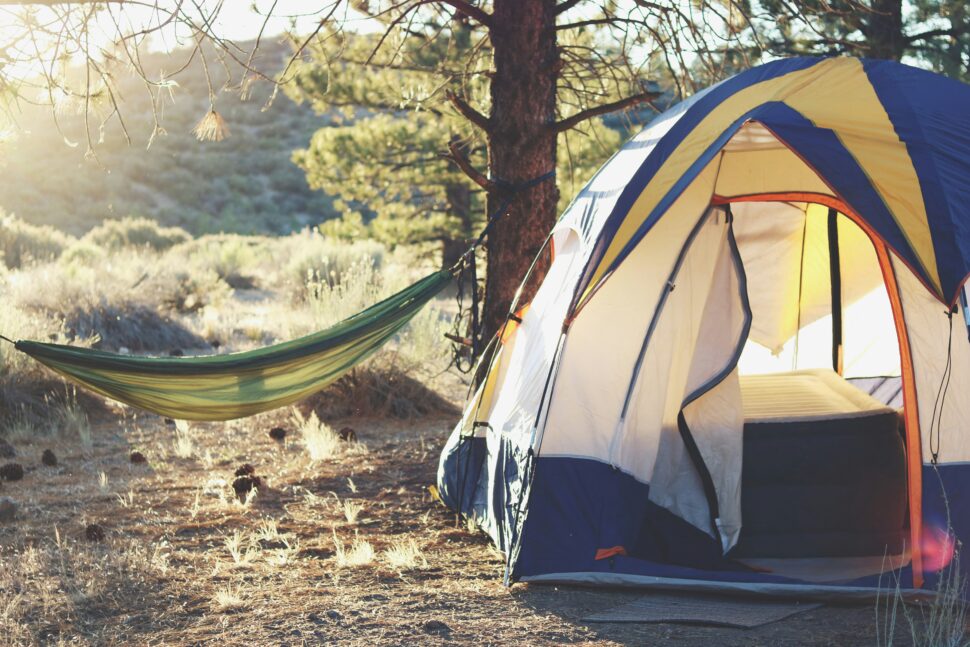
- Packing Checklist: A first aid kit, shelter (such as a tent and sleeping bag), sunscreen, and a water filtration tool.
- Safety Tip: Share your trip details with someone you trust. Staying on the trail is crucial for safety, as it makes it easier for rescuers to locate you in case of an emergency.
What To Expect Along The Trail
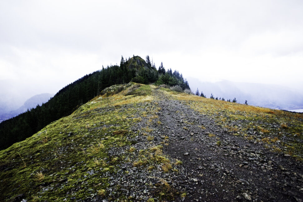
Once you decide to embark on the journey of hiking the Pacific Crest Trail, expect a diverse and challenging landscape. No two sections on the trail are the same. Be prepared for high alpine environments, dramatic elevation changes, wildlife encounters, and resupply water.
If you plan to hike the entire trail in four to six months, expect to see rattlesnakes in the desert areas, bears in the Sierra, bobcats, cougars, coyotes, elk, mountain goats, and roadrunners.
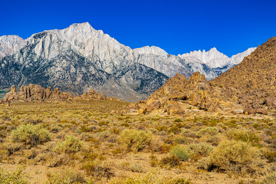
On your journey, take time to savor the breathtaking views and memorable moments. Notable landmarks along the way include Foster Point in Mount Laguna, Southern California. As you reach the Sierra Nevada, keep in mind that this range marks the highest elevations on the PCT. Be sure to look for Forester Pass, the trail’s highest point at over 13,000 feet. Walker Pass is another significant stop, recognized as a historical landmark.
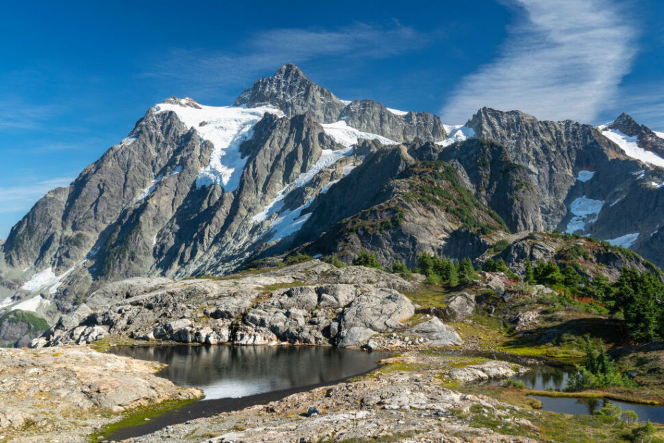
Once in Central California, the Kearsarge Pass is a bucket list landmark for hikers. In the gorgeous state of Oregon, Jefferson Park is a must-see. Lastly, if you’re traveling northbound in Washington, the North Cascades are filled with lush forests and mountain ranges that are great for reflecting on the incredible journey you embarked on.
- Trail Etiquette: Leave No Trace, a 1990s program founded by conservationists and outdoor industry representatives, is a national educational program that informs visitors about reducing the damage outdoors to preserve plants and wildlife. Familiarize yourself with the Leave No Trace principles.
- Photography Tip: There’s no right or wrong picture, but the most iconic photo on the trail is of Mount Whitney’s Summit, which captures the expansive panorama of Sierra Nevada.
Know Before You Go: Important Trail Information
Thru-hikers and overnight campers will need permits and can pick them up at the ranger station. Day hikers usually do not need a license, but if one is required, permits can be filled at many trailheads. Be sure to check with local rangers in each state to see what is needed. A state campfire permit may be required for hikers staying overnight in California. Most permits are free, but small donations of around $10 and $15 are recommended for the Pacific Crest Trail Association.
According to the association, most hikers spend between $8,000 and 12,000+ on a thru-hike.
Staying up to date with weather conditions cannot be stressed enough. There’s an interactive map on weather.gov, and current conditions can be checked on the land agency website.
When starting the PCT, most people park at the southern terminus in Campo, California. Unfortunately, regarding hydration, there are long stretches where water is not available, so be sure to plan to go 30 or 40 miles without water in some parts. There is a PCT Water Report hikers can follow.
- Camping Information: Designated camping areas on the PCT include Obsidian LEA, Pamelia/Shale Lake LEA, Jefferson Park, Warm Springs Reservation, and North Cascades National Park.
- Cell Service: Cell phone reception can be spotty. You should expect it to be hit or miss. Be sure to carry a backup for communication, such as a satellite messenger, when you’re away from cellphone towers.
Hiking the Pacific Crest Trail is an incredibly unique experience. Even with its challenges along the way, the hike allows you to push personal and mental boundaries. The PCT offers views and one-on-one encounters with nature that you cannot get from a car or airplane.
Above anything else, a level of self-discovery happens on your journey on PCT that invites personal reflection, self-awareness, and growth. There are very few experiences in the world that allow this.


