A severe thunderstorm outbreak is set to unleash a barrage of extreme weather conditions across the United States. This weather event will potentially cause travel disruptions and put millions of Americans at risk. The powerful storm system will unleash a volatile mix of heavy rain, snow, fierce winds, and the threat of tornadoes, affecting nearly every region of the country.
The storm is forecasted to make its first impact along the Pacific Coast on Wednesday, March 13, 2025. As it moves inland, it will gather strength and expand its reach, stretching across nearly the entire central United States by Friday. California and other western states are bracing for the storm’s initial onslaught.
Storm’s Path And Timeline
Coastal areas, particularly in Southern California, face the threat of flash flooding and debris flows, especially in regions recently affected by wildfires. The Sierra Nevada mountains could see an impressive 2 to 4 feet of snow. Widespread wind gusts of 40 to 70 mph are also expected across the region.
As the severe thunderstorm outbreak strengthens and moves eastward, it will create a volatile weather scenario across the central U.S. AccuWeather senior meteorologist Tom Kines told USA Today that this could be one of the strongest storms on record in terms of low pressure, potentially leading to a “very significant, very strong storm.”
From Friday into the weekend, the Plains region faces the risk of heavy snow and possible blizzard conditions. Simultaneously, there’s a heightened threat of severe thunderstorms across a vast area spanning from Texas to the Dakotas.
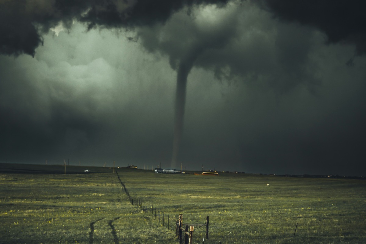
Tornado Outbreak Concerns
Meteorologists are particularly concerned about the potential for a tornado outbreak. The storm system could spawn dozens of twisters from the Gulf Coast to the Midwest. This means it poses a significant threat to life and property. One of the most widespread impacts of this storm will be damaging winds. Gusts of 65 to 75 mph are expected, with some locations potentially seeing wind speeds up to 100 mph.
These hurricane-force winds could lead to widespread power outages, downed trees, and dangerous travel conditions. In the drought-stricken Southwest, these high winds and low humidity will create critical fire weather conditions. States like Texas, Arizona, and New Mexico are at particular risk of rapidly spreading brush fires.
Travel Implications
This storm’s diverse and severe weather conditions will cause travel disruptions nationwide. Air travelers should anticipate flight delays and cancellations. These changes will affect areas experiencing high winds or severe thunderstorms. Road travel will also become hazardous in many regions. There’s potential for whiteout conditions in areas experiencing heavy snow and blizzard-like weather.
As the storm system continues its eastward march, major cities along the I-95 corridor, including Washington D.C., Philadelphia, New York, and Boston, could face severe weather threats by Sunday. While the exact impacts are still uncertain, residents and travelers in these areas should stay alert and prepared for potential disruptions.
Adding to the extreme nature of this weather event, many areas across the central United States may experience unusually warm temperatures ahead of the storm. Cities like Chicago could see temperatures approaching record highs. On the other hand, some southern regions will potentially reach triple digits – well above average for this time of year.
Preparing For The Storm
Residents and travelers must stay informed about local weather conditions and heed any warnings or advisories issued by the National Weather Service. Those with travel plans should consider potential disruptions and prepare to adjust their schedules if necessary. Emergency management officials across the affected regions are urging people to have emergency kits ready, secure loose outdoor items, and have a plan in place in case of power outages or the need to evacuate quickly.


