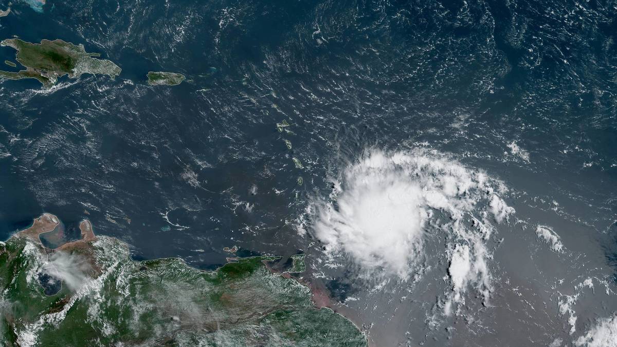
People who live or are going to the Southern Caribbean islands must be extremely cautious over the next few days. As AccuWeather Global Weather Center reported, a massive tropical rainstorm, that has been designated as Potential Tropical Cyclone Two by the National Hurricane Center (NHC), is forecasting to travel across the southern Caribbean Sea while remaining very close to the shores of South America this week. Trinidad and Tobago, Grenada, Margarita, Bonaire, Curacao and Aruba are the islands that can be hit by this tropical storm.
AccuWeather meteorologists say the system could strengthen into Tropical Storm Bonnie at any time over the next several days, but it is when the system approaches Central America this weekend that rapid strengthening could occur, with forecasters not ruling out the possibility that the system could reach Category 1 hurricane strength.
As of 11 a.m. EDT Tuesday, the storm was located 260 miles (418 km) to the east of the island of Trinidad and was moving swiftly toward the west at 23 mph (37 km/h). Maximum sustained winds were near 40 mph (65 km/h). Tropical-storm-force winds extend outward up to 60 miles (95 km) from the center, according to the NHC.
“While waters are quite warm, dry air is absent and wind shear is low; the rainstorm will struggle with proximity to the large landmass of South America for the balance of this week,” AccuWeather Chief On-Air Meteorologist Bernie Rayno said. In simple terms, wind shear is the presence of strong straight-line breezes that can prevent or limit tropical development.
Small Caribbean islands have long been severely affected by the Atlantic hurricane season, the effects of which have been worsening as the climate crisis deepens.
The levels of rainfall may vary considerably, from 1-3 inches to 4-6 inches in the region, which can cause flooding and landslides as well as possible damage from high winds.
Social media platforms have been filled with updates and tips on how to prepare for the massive tropical rainstorm, including securing pets.


