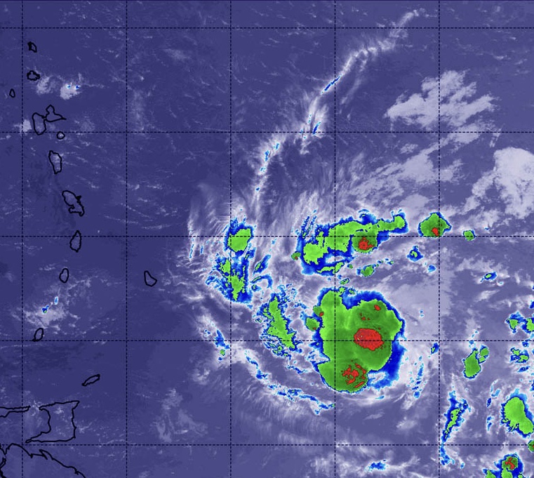
A tropical storm warning is in effect for several Caribbean islands as Tropical Storm Dorian approached the region on Monday morning.
Just before noon ET on Monday, the storm was approximately 135 miles southeast of Barbados, moving to the northwest at around 14 mph, an alert from the National Hurricane Center reads.
Forecasters said the storm is expected to follow a path that could take it through a number of Caribbean islands.
According to the National Hurricane Center, Dorian is expected to bring tropical storm conditions to portions of the Lesser Antilles Monday night and into Tuesday.

The northern portion of Windward Islands is expected to get hit the hardest with 60 mph winds and up to 10 inches of rain.
Dorian is also expected to produce 3-to-8 inches of rainfall from Martinique to St. Vincent, including Barbados.
One island of concern is Puerto Rico and neighboring islands where the area could be hit Tuesday or Wednesday with minimal hurricane conditions.
As of Monday, a tropical storm warning is in effect for Martinique, Barbados, St. Lucia and St. Vincent and the Grenadines.
Dorian is the fourth named storm of the Atlantic hurricane season so far this year and is expected to grow into a lower-level Category 1 hurricane which means its sustained winds would narrowly top the 74-mph threshold for a hurricane.
Dorian currently has maximum sustained winds of 60 mph but the NHC warns, “that compact tropical cyclones like Dorian are often challenging to predict.”